
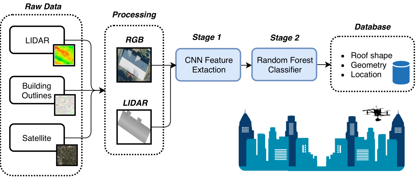
Geographic information systems (GIS) provide accurate maps of terrain, roads, waterways, and building footprints and heights. Aircraft, particularly small unmanned aircraft systems (UAS),can exploit this and additional information such as building roof structure to improve navigation accuracy and safely perform contingency landings particularly in urban regions. However, building roof structure is not fully provided in maps. This project fuses satellite imagery and airborne Light Detection and Ranging (LiDAR) data through multiple stages of machine learning classifiers to accurately characterize building rooftops.